
This text was obtained via automated optical character recognition.
It has not been edited and may therefore contain several errors.
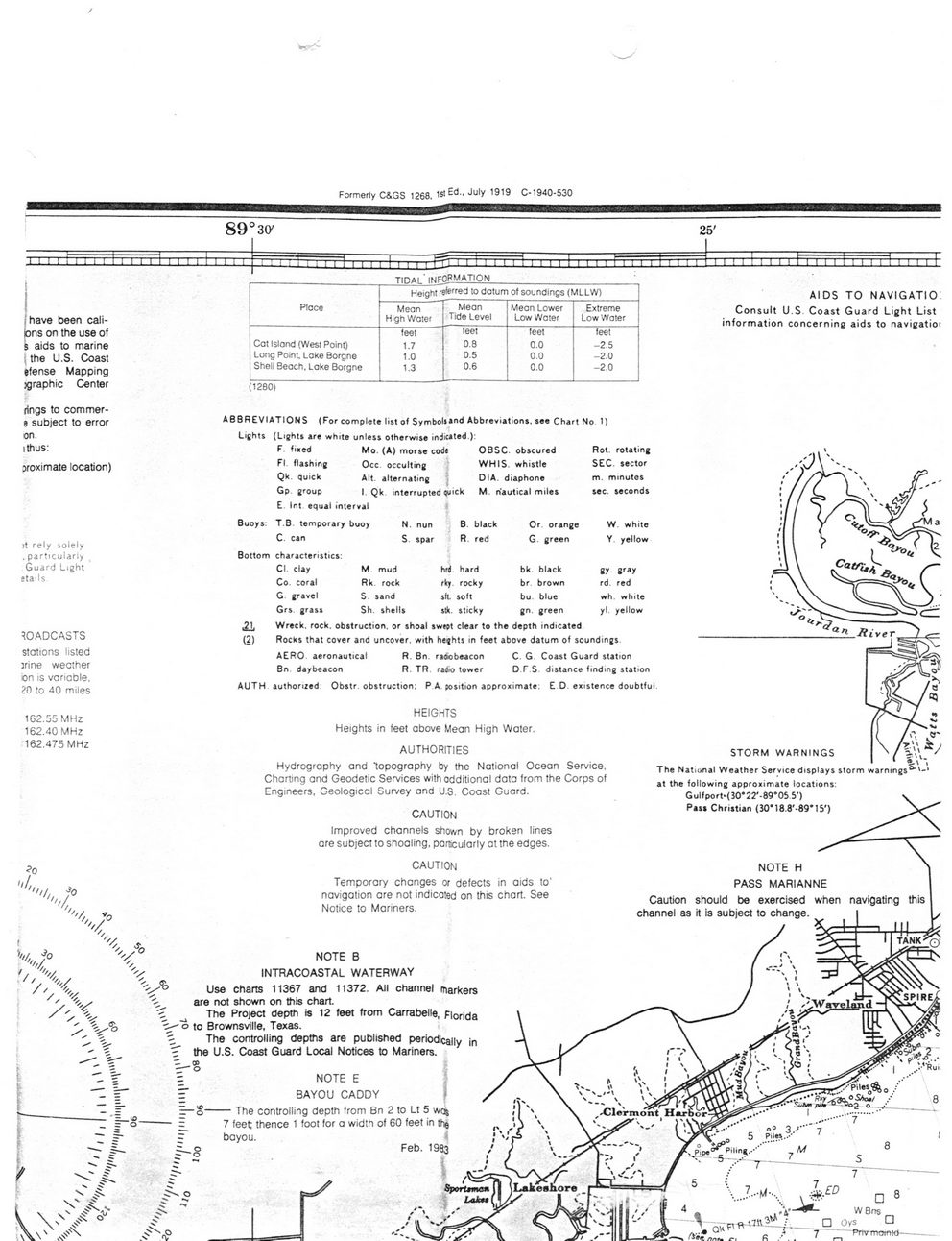
Formerly C&GS 1268, 1st Ed., July 1919 C-1940-530
(have been cali-tons on the use of i aids to marine j the U.S. Coast efense Mapping jgraphic Center
89°3(y
Place	Height referr©d to datum of soundings (MLLW)
	Mean High Water	Mean Tide Level	Mean Lower Low Water	Extreme Low Water
	feet	feet	feet	feet
Cat Island (West Point)	1.7	0.8	0.0	-2.5
Long Point, Lake Borgne	1.0	0.5	0.0	-2.0
Shell Beach. Lake Borgne	1.3	0.6	0.0	-2.0
(1280)
AIDS TO NAVIGATION Consult U.S. Coast Guard Light List information concerning aids to navigatiot
rings to commer-0 subject to error on. ithus:
oroximate location)
)t rely solely , particularly Guard Light etails
ROADCASTS stations listed jrine weather on is variable.
20 to 40 miles
162.55 MHz 162.40 MHz 162.475 MHz
v°
I, ''//
'aX
ABBREVIATIONS (For complete list of Symbol**od Abbreviations, see Chart N Lights (Lights are white unless otherwise indicated ):
F fixed FI. flashing Qk. quick Gp. group
Mo. (A) morse cod# Occ. occulting Alt. alternating *j I. Qk. interrupted quick
OBSC. obscured WHIS. whistle DIA. diaphone M. nautical miles
Buoys:
Int equal interval T.B temporary buoy C. can Bottom characteristics:
Cl. clay	M. mud
Co. coral	Rk. rock
G. gravel	S sand
Grs. grass	Sh. shells
N. nun S. spar
black
red
Or. orange G. green
o D
Rot. rotating SEC. sector m. minutes sec. seconds
W. white Y. yellow
hrd hard	bk.	black	gy. gray
rky. rocky	br.	brown	rd. red
sft. soft	bu.	blue	wh. white
stk. sticky	gn.	green	yl. yellow
.21. Wreck, rock, obstruction, or shoal swept clear to the depth indicated.
(2) Rocks that cover and uncover, with heghts in feet above datum of soundings.
AERO, aeronautical	R. Bn. radwbeacon	C. G. Coast Guard station
Bn. daybeacon	R. TR. radio tower	D.F.S. distance finding station
AUTH authorized: Obstr. obstruction: P.A. position approximate: E.D. existence doubtful.
HEIGHTS
Heights in feet above Mean High Water.
AUTHORITIES
Hydrography and topography by the Nationaf Ocean Service.
Charting and Geodetic Services with additional data from the Corps of Engineers, Geological Survey and U.S. Coast Guard.
CAUTION
Improved channels shown by broken lines are subject to shoaling, particularly at the edges.
STORM WARNINGS The National Weather Service displays storm warnings0"' at the following approximate locations: Gulfport»(30*22'-89*05.5')
Pass Christian <30M8.8'-89*15')
CAUTION
Temporary changes or defects in aids to‘ navigation are not indicated on this chart. See Notice to Mariners.
NOTE H PASS MARIANNE Caution should be exercised when channel as it is subject to change
V	NOTE	B
\	INTRACOASTAL WATERWAY
Use charts 11367 and 11372. All channel markers ^ are not shown on this chart, c	The	Project depth is 12 feet from Carrabelle, Florida
£>	i—o to Brownsville, Texas.
■; The controlling depths are published periodically the U.S. Coast Guard Local Notices to Mariners.
NOTE E BAYOU CADDY	)
— The controlling depth from Bn 2 to Lt 5 wc% 7 feet; thence 1 foot for a width of 60 feet in the bayou.	4
Feb. 1983
J'
□ 8 WBrrs □ Oys O f Pnvrrotfttd--------------
Claiborne Property 001