
This text was obtained via automated optical character recognition.
It has not been edited and may therefore contain several errors.
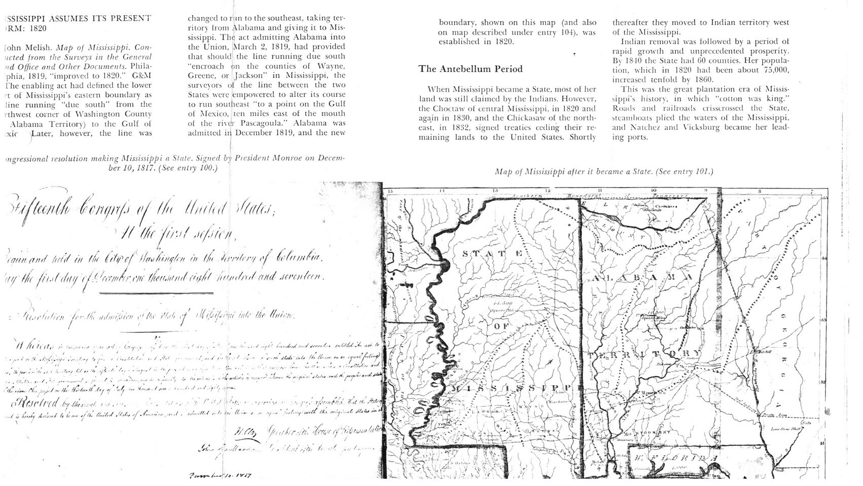
SSISSIPPI ASSUMES ITS PRESENT >RM: 1820
fohn Melish. Map of Mississippi. Con-•icted from the Surveys in the General nd Office and Other Documents. Phila-phia, 1819, "improved to 1820." G&M I'he enabling act had defined the lower n of Mississippi’s eastern boundary as line running “due south” from the rthwest corner of Washington County Alabama Territory) to the Gulf of xic *Later, however, the line was
mgressional resolution making Mississippi a State. Signed by President Monroe on December 10, 1817. (See entry 100.)
__ \ *
changed to run to the southeast, taking territory from Alabama and giving it to Mississippi. The act admitting Alabama into the Union, March 2, 1819, had provided that should the line running due south "encroach on the counties of Wayne, Greene, or Jackson” in Mississippi, the surveyors of the line between the two States were empowered to alter its course to run southeast “to a point oil the Gulf of Mexico, ten miles east of the mouth of the rivet Pascagoula.” Alabama was admitted iii December 1819, and the new
boundary, shown on this map (and also on map described under entry 104), was established in 1820.
The Antebellum Period
When Mississippi became a State, most of her land was still claimed by the Indians. However, the Choctaw of central Mississippi, in 1820 and again in 1830, and the Chickasaw of the northeast, in 1832, signed treaties ceding their remaining lands to the United States. Shortly
thereafter they moved to Indian territory west of the Mississippi.
Indian removal was followed by a period ol rapid growth and unprecedented prosperity. By 1810 the State had 60 counties. Her population, which in 1820 had been about 75,000, increased tenfold by I860.
This was the great plantation era of Mississippi's history, in which "cotton was king.” Roads and railroads crisscrossed the State, steamboats plied the waters of the Mississippi, and Natchez and Vicksburg became her leading ports.
Map of Mississippi after it became a State. (See entry 101.)
(rcnt/nfi oj (in l(ni(u( 'S((f(a;
' // f/tC jf) '■ > ( ,lf/jfC/t,
<(r«n (inti iufd in fh( fiftpcf if(w'/tinqin in (fu Jirrifrni (u'ft) mf'tn, tty' f/i(!i(->((hdf y.<'„Uw	iuf/'drd^and .leroi/rrn.
•: ‘ '((.K-hiirn !<'>■.//(', nJwi/jiai c'/hf M/it cj '<0<[.>r>/;i ini (it finish.
X	' .	...	•
// /{ ( f( (ft' f i'ft;.'!/ t.-r ■ tr ,t ■/. ■	■,	»’	’’	-,f II ,	-	Ptn •*>.- .*■•/ .tyi’-* An m/rtj/ .r m/	Sh *f ot' f*
rn ar . i/unC
" f . • •. . . , , • . i. • .1,, ■,
V, X W- /*."	•>	if*	i'*~/	/•'./	t*	'fi	t-	f-f	■	'	* f *'	’ V ”	'	""	*	• f J j/mI
...	✓,	>./	,<.......... 	u -/ ■ < <4 «.«>' f	-1' - r' ■"1'“ Yr" ,
fi. ;.-.,/■■(■■* U, fit- (»Sli. /y y ’‘.j ■-	•' —
('Hr.fr if((/
(Si*" .iii. ft.:M .'Ur.	,.r. J .	r./...My r, /r !*, ((- .
^ ^ \ \
Hancock County Antebellum-Mississippi-Alabama-map