
This text was obtained via automated optical character recognition.
It has not been edited and may therefore contain several errors.
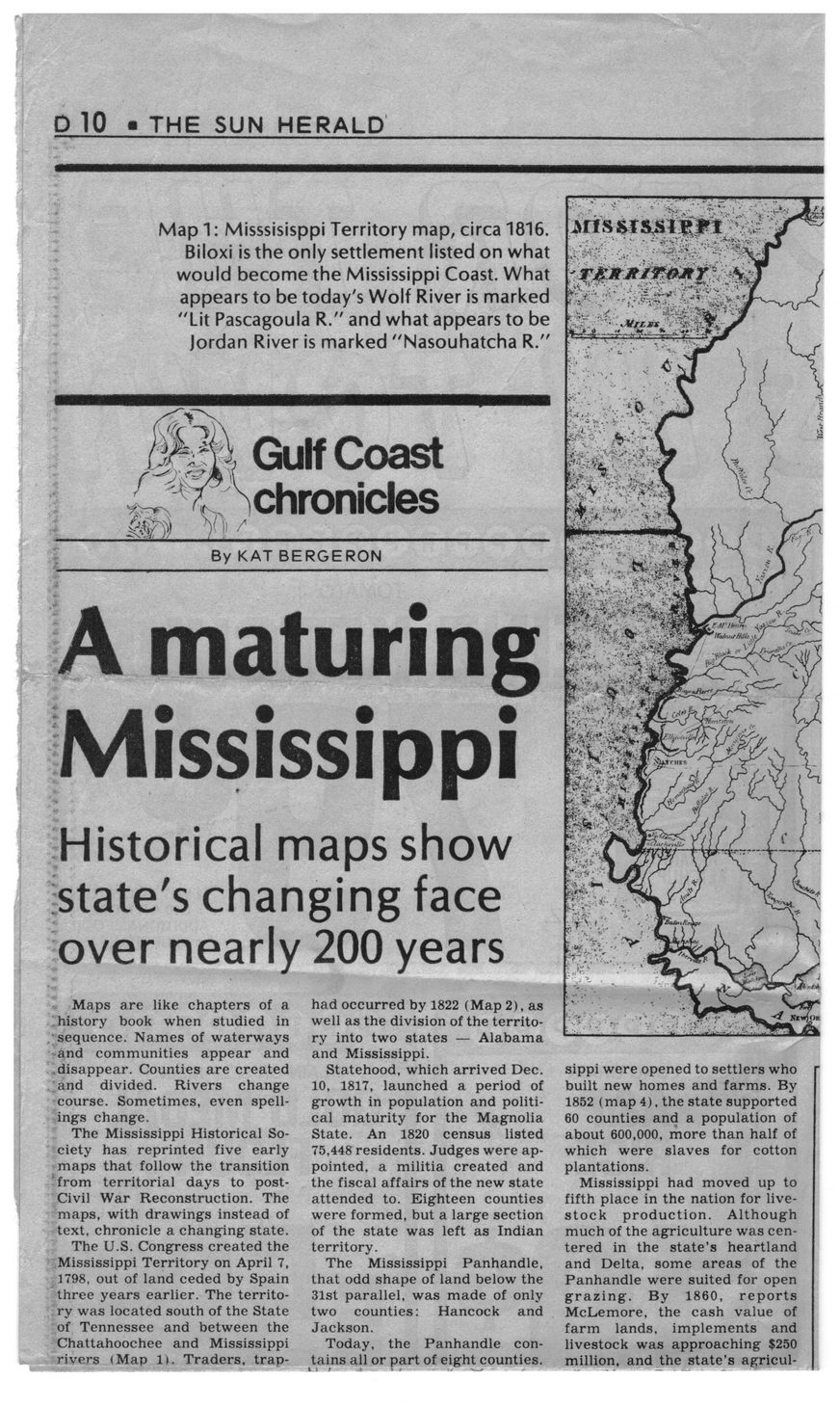
D 10 • THE SUN HERALD
Map 1: Misssisisppi Territory map, circa 1816. Biloxi is the only settlement listed on what would become the Mississippi Coast. What appears to be today's Wolf River is marked "Lit Pascagoula R." and what appears to be jordan River is marked "Nasouhatcha R."
Gulf Coast chronicles
By KAT BERGERON
A maturing Mississippi
Historical maps show state's changing face over nearly 200 years
Maps are like chapters of a history book when studied in sequence. Names of waterways -and communities appear and .disappear. Counties are created and divided. Rivers change course. Sometimes, even spellings change.
The Mississippi Historical Society has reprinted five early maps that follow the transition ‘from territorial days to post-Civil War Reconstruction. The maps, with drawings instead of text, chronicle a changing state.
The U.S. Congress created the Mississippi Territory on April 7, 1798, out of land ceded by Spain three years earlier. The territory was located south of the State of Tennessee and between the Chattahoochee and Mississippi rivers (Map li. Traders, trap-
had occurred by 1822 (Map 2), as well as the division of the territory into two states — Alabama and Mississippi.
Statehood, which arrived Dec. 10, 1817, launched a period of growth in population and political maturity for the Magnolia State. An 1820 census listed 75,448 residents. Judges were appointed, a militia created and the fiscal affairs of the new state attended to. Eighteen counties were formed, but a large section of the state was left as Indian territory.
The Mississippi Panhandle, that odd shape of land below the 31st parallel, was made of only two counties:	Hancock and
Jackson.
Today, the Panhandle contains all or part of eight counties.
sippi were opened to settlers who built new homes and farms. By 1852 (map 4), the state supported 60 counties and a population of about 600,000, more than half of which were slaves for cotton plantations.
Mississippi had moved up to fifth place in the nation for livestock production. Although much of the agriculture was centered in the state's heartland and Delta, some areas of the Panhandle were suited for open grazing. By 1860, reports McLemore, the cash value of farm lands, implements and livestock was approaching $250 million, and the state’s agricul-
Hancock County History General Newspaper Clippings Mississippi-Maps-(1)