
This text was obtained via automated optical character recognition.
It has not been edited and may therefore contain several errors.
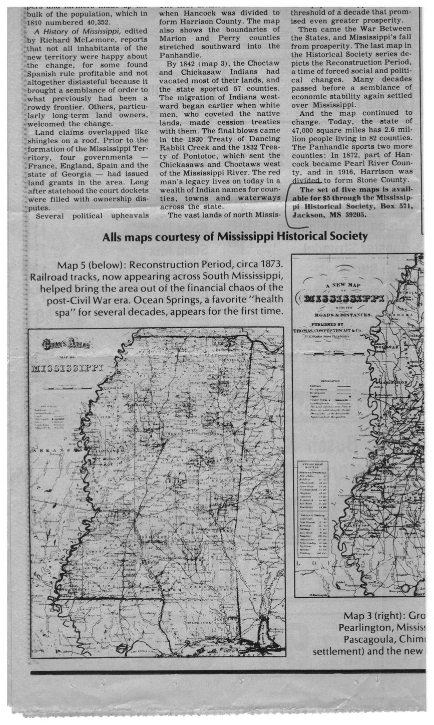
(*1IU AIM «*<V* W ••<«*«*■ nap »••»
;bulk of the population, which in 1810 numbered 40,352.
•	A History of Mississippi, edited by Richard McLemore, reports .that not all inhabitants of the new territory were happy about the change, for some found Spanish rule profitable and not altogether distasteful because it brought a semblance of order to what previously had been a rowdy frontier. Others, particularly long-term land owners, welcomed the change.
Land claims overlapped like shingles on a roof. Prior to the ; formation of the Mississippi Territory, four governments — France, England, Spain and the state of Georgia — had issued land grants in the area. Long after statehood the court dockets were filled with ownership disputes.
Several political upheavals
when Hancock was divided to form Harrison County. The map also shows the boundaries of Marion and Perry counties stretched southward into the Panhandle.
By 1842 (map 3), the Choctaw and Chickasaw Indians had vacated most of their lands, and the state sported 57 counties. The migration of Indians westward began earlier when white men, who coveted the native lands, made cession treaties with them. The final blows came in the 1830 Treaty of Dancing Rabbit Creek and the 1832 Treaty of Pontotoc, which sent the Chickasaws and Choctaws west of the Mississippi River. The red man’s legacy lives on today in a wealth of Indian names for counties, towns and waterways across the state.
The vast lands of north Missis-
threshold of a decade that promised even greater prosperity.
Then came the War Between the States, and Mississippi’s fall from prosperity. The last map in the Historical Society series depicts the Reconstruction Period, a time of forced social and political changes. Many decades passed before a semblance of economic stability again settled over Mississippi.
And the map continued to change. Today, the state of 47,000 square miles has 2.6 million people living in 82 counties. The Panhandle sports two more counties: In 1872, part of Hancock became Pearl River County, and in 1916, Harrison was HivirinH tn form Stone County.
The set of five maps is available for $5 through the Mississippi Historical Society, Box 571, Jackson, MS 39205.
Alls maps courtesy of Mississippi Historical Society
Map 5 (below): Reconstruction Period, circa 1873. Railroad tracks, now appearing across South Mississippi, helped bring the area out of the financial chaos of the post-Civil War era. Ocean Springs, a favorite "health spa” for several decades, appears for the first time.
Map 3 (right): Gro Pearlington, Missis; Pascagoula, Chimi settlement) and the new
Hancock County History General Newspaper Clippings Mississippi-Maps-(2)